
Title
Map of Arkansas Showing the Distribution of Forests with Special Reference to the Lumber Industry
Preview
Date Original
1881
Description
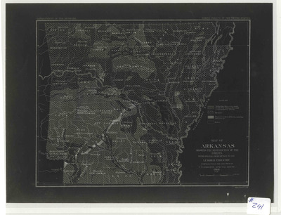
Negative photostat of the state of Arkansas showing the location of hardwoods and pines across the state and also showing the location of prairies. Written in the upper right corner of the map, "Tenth Census of the United State"
Biographical/Historical Note
The timber industry in Arkansas developed in all directions after the Civil War. The abundant forests of the state made it possible over the years to produce lumber, kraft paper, fine paper, newsprint, chemicals, charcoal, and many other products. Between 1880 and 1920, community development enjoyed a beneficial relationship with the timber industry, as when the timber industry arrived in a town, many new services and institutions—schools, churches, stores, police and fire departments, hospitals, newspapers, and utilities—were needed to support the growing numbers of employees and their families.
Physical Description
Map, 11.75" x 8.75"
Contributor
Department of the Interior
Geographical Area
Arkansas
Language
English
Identifier
Map0291
Resource Type
Image
Collection
Map collection
Publisher
Arkansas State Archives
Contributing Entity
Arkansas State Archives
Recommended Citation
Map of Arkansas Showing The Distribution of Forests with Special Reference to the Lumber Industry, Map0291, Map collection, Arkansas State Archives, Little Rock, Arkansas
Rights
Use and reproduction of images held by the Arkansas State Archives without prior written permission is prohibited. For information on reproducing images held by the Arkansas State Archives, please call 501-682-6901 or email at state.archives@arkansas.gov.
Disciplines
United States History


