
Preview
Date Original
1906
Description
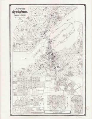
Black and white printed map of Hot Springs in Garland County, Arkansas. This map was originally printed in 1895 and reprinted in 1906. The map shows streets and neigborhoods, churches, schools, parks, post office, hotels, hospitals, fire department and some residences and businesses.
Biographical/Historical Note
Located in Central Arkansas in Garland County, Hot Springs was incorporated in 1851. It sits along the Ouachita River in the Ouachita Mountains. The center of Hot Springs is the oldest federal reserve in the United States, today preserved as Hot Springs National Park. The perceived healing properties of the hot spring water were discovered centuries ago, and the waters were legendary among several Native American tribes. Following federal protection in 1832, the city developed into a successful spa town.
Through its colorful history, Hot Springs has been home to Major League Baseball spring training, illegal gambling, speakeasies and gangsters such as Al Capone, horse racing at Oaklawn Park, the Army and Navy Hospital, and 42nd President Bill Clinton. It is currently the 11th largest city in Arkansas.
The C.H.Weaver Company was a publishing company in Hot Springs in the early 1900s, which also operated a bookstore in town.
Physical Description
Map, 22" x 17"
Contributor
The C.H. Weaver Co.
Geographical Area
Hot Springs, Garland County, (Ark.)
Language
English
Identifier
Map1538
Resource Type
Image
Collection
Map collection
Publisher
Arkansas State Archives
Contributing Entity
Arkansas State Archives
Recommended Citation
Map of the City of Hot Springs with Subdivisions and Additions, Map1538, Map collection, Arkansas State Archives, Little Rock, Arkansas.
Rights
Use and reproduction of images held by the Arkansas State Archives without prior written permission is prohibited. For information on reproducing images held by the Arkansas State Archives, please call 501-682-6901 or email at state.archives@arkansas.gov.
Disciplines
United States History


