
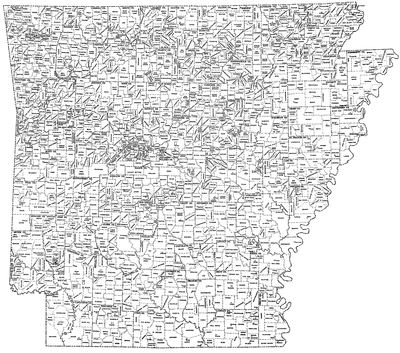
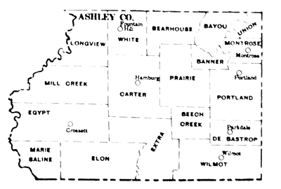
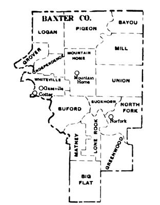
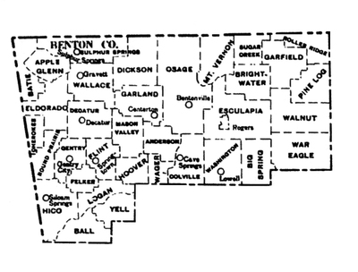
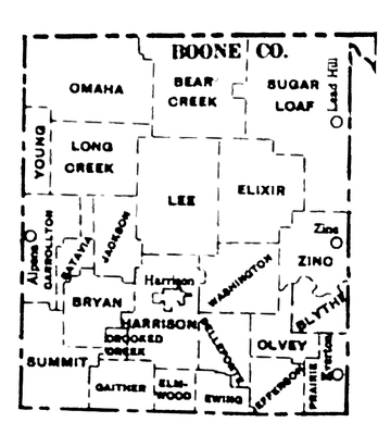
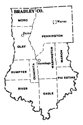
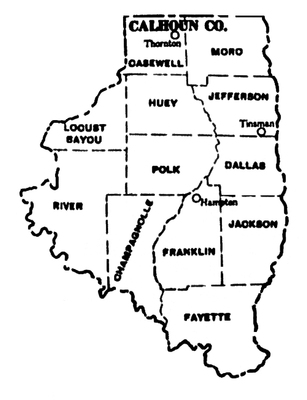
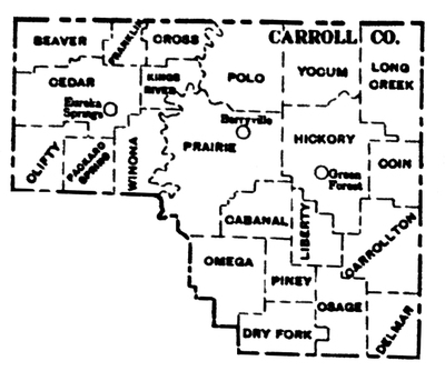
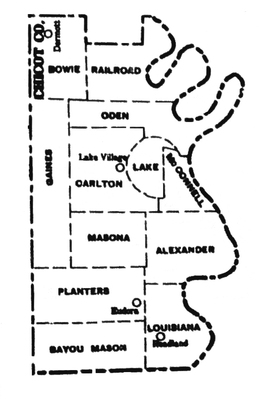
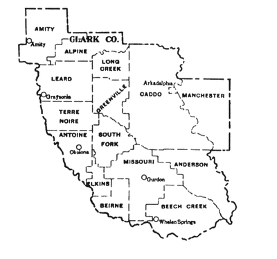
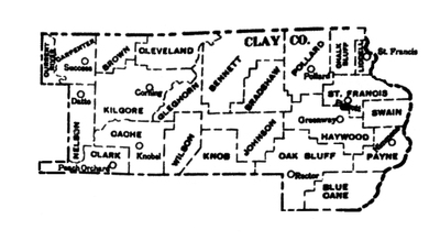
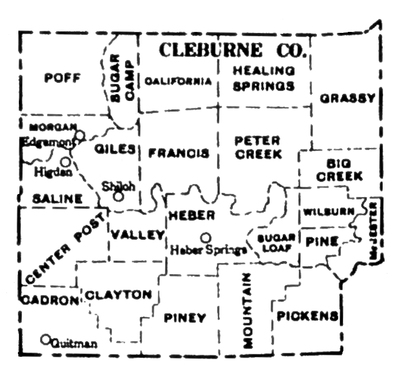
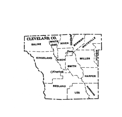
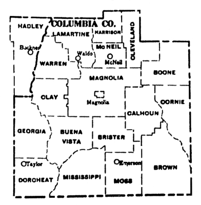
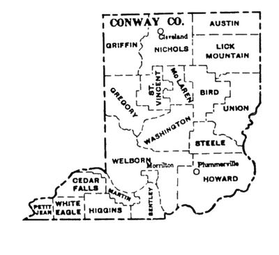
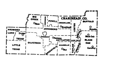
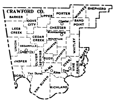
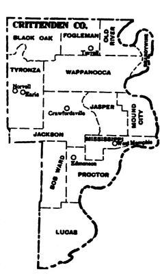
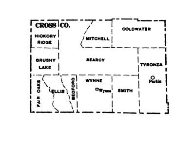
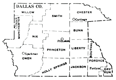
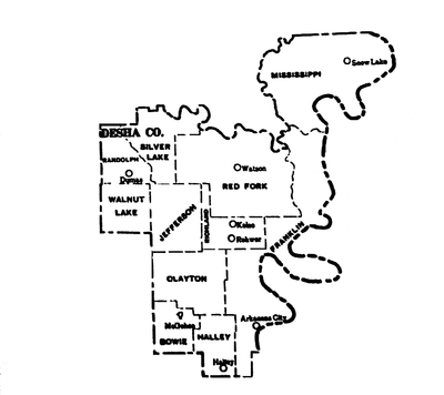
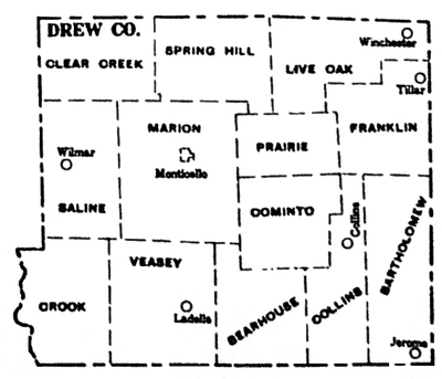
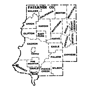
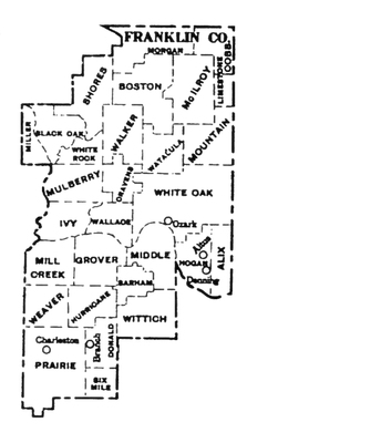
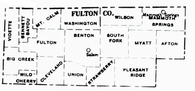
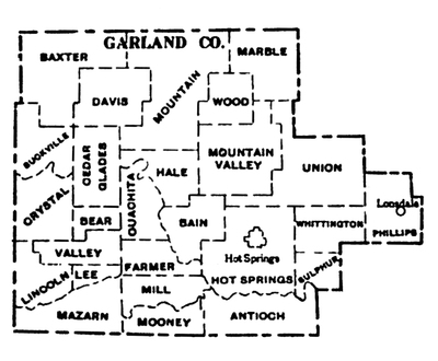
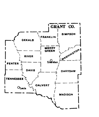
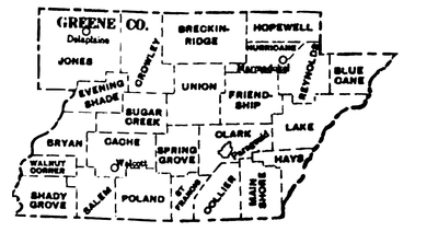
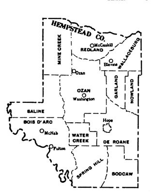
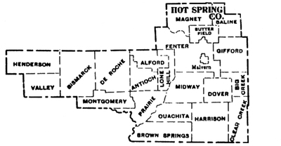
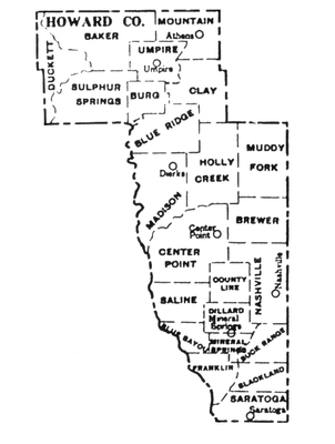
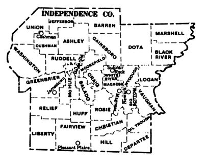
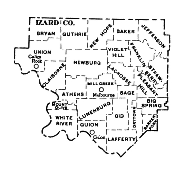
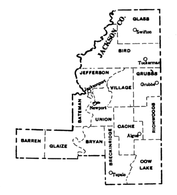
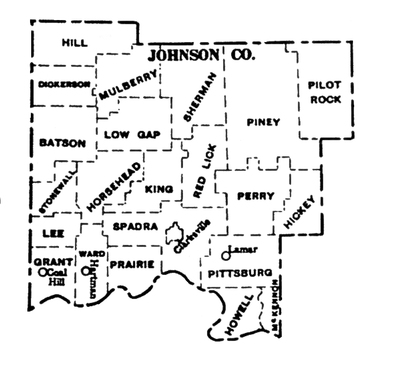
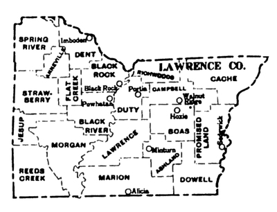
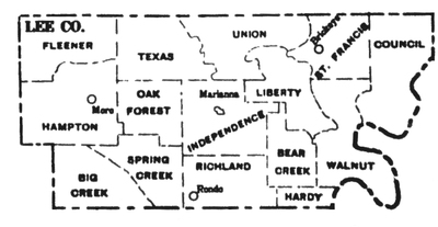
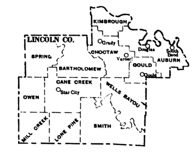
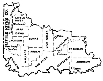
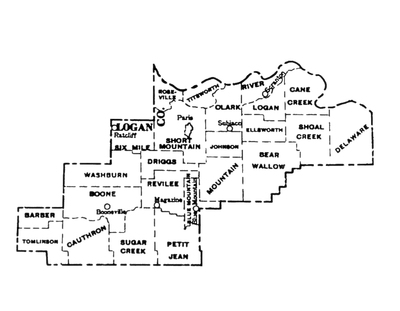
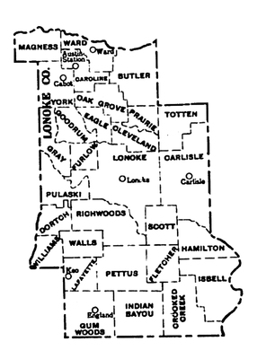
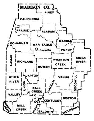
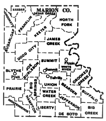
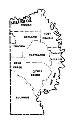
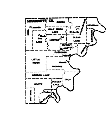
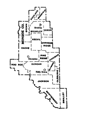
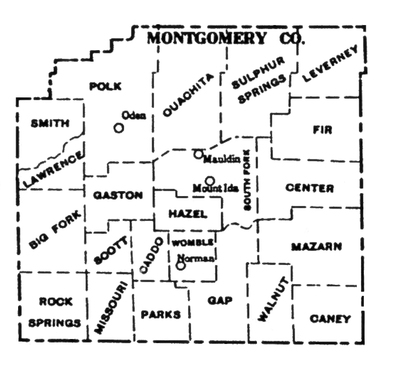
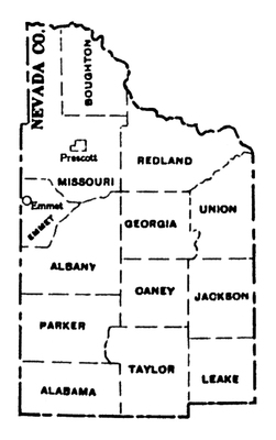
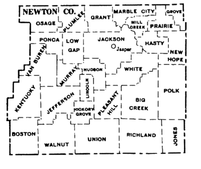
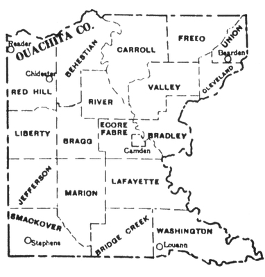
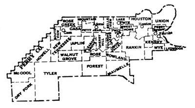
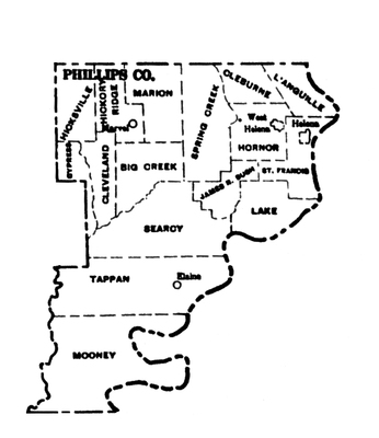
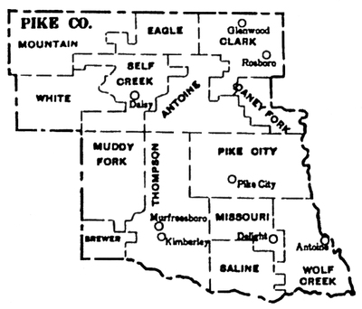
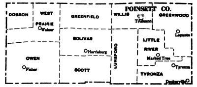
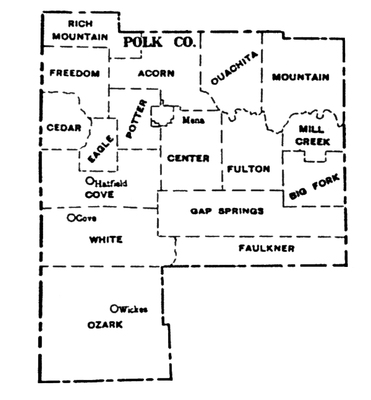
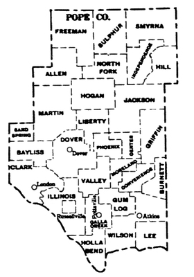
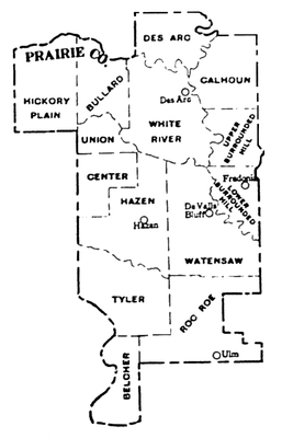
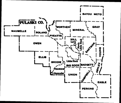
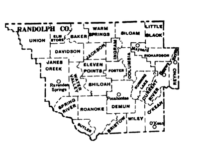
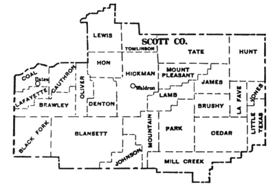
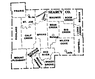
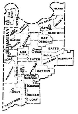
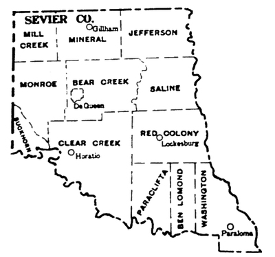
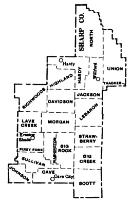
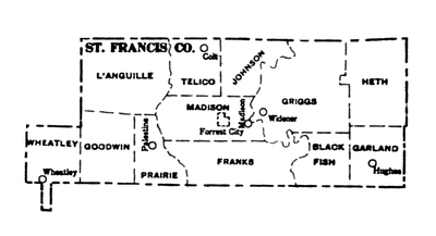
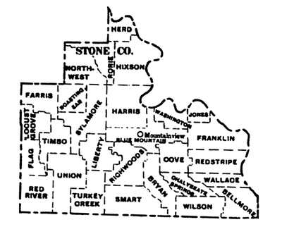
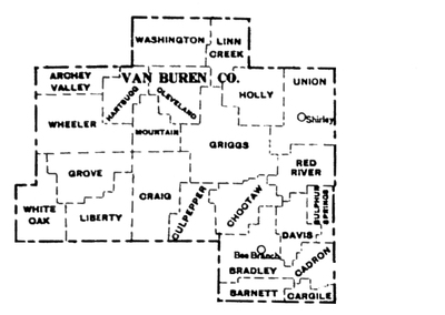
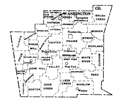
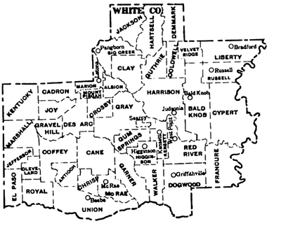
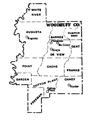
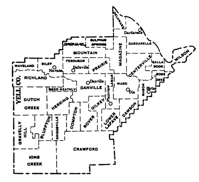
These township maps depict Arkansas’s seventy-five counties as they existed at the time of the 1930 United States Census.
The state of Arkansas is divided into political subdivisions or administrative districts called counties. Counties are further subdivided into townships. These maps are helpful for census research since Arkansas’s census records for population provide information primarily by township.
Printing is not supported at the primary Gallery Thumbnail page. Please first navigate to a specific Image before printing.


