
Preview
Date Original
1858
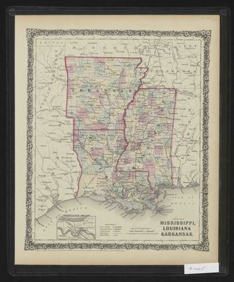
Description
Printed color map of Arkansas, Mississippi and Louisiana showing the counties in each state. The bottom of the map shows a smaller map of the vicinity of New Orleans.
Physical Description
Map, 12" x 14.5"
Contributor
Clerk's Office of the District Court of the United States for the Southern District of New York
Geographical Area
Arkansas, Mississippi, Louisiana
Language
English
Identifier
Map1425
Resource Type
Image
Collection
Map collection
Publisher
Arkansas State Archives
Contributing Entity
Arkansas State Archives
Recommended Citation
Map of Arkansas, Mississippi and Louisiana, Map1425, Map collection, Arkansas State Archives, Little Rock, Arkansas.
Rights
Use and reproduction of images held by the Arkansas State Archives without prior written permission is prohibited. For information on reproducing images held by the Arkansas State Archives, please call 501-682-6901 or email at state.archives@arkansas.gov.
Disciplines
United States History


