
Preview
Date Original
1936
Description
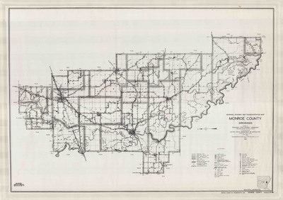
Black and white printed highway and transportation map of Monroe County, Arkansas. The legend is in the bottom right corner. The map shows roads and highways, bridges, railroads, levees, drainage ditches, towns, cemeteries, golf courses, toll ferries, farm units and dwellings, businesses, churches, sawmills, factories, camps and lodges and parks.
Biographical/Historical Note
Located in Eastern Arkansas, Monroe County was established in 1829. Clarendon is the county seat.
The Arkansas State Highway Commission was created in 1913 by Act 302 during the 39th Arkansas General Assembly. Originally consisting of three members appointed by the Governor, its earliest mission was to supervise and maintain road construction while coordinating with counties and communities. Throughout its first few decades of existence, the Commission faced difficulties with funding, support and controversy. In the 1940's, the Commission's problems began to even out with the passing of Acts 42 and 239, Amendment 42 and the election of Governor Sid McMath. Membership was increased to 12 members and Commission oversight increased.
Physical Description
Map, 25.5" x 18"
Contributor
United State Department of Agriculture, Bureau of Public Roads
Geographical Area
Monroe County, Arkansas
Language
English
Identifier
Map1276
Resource Type
Image
Collection
Map collection
Publisher
Arkansas State Archives
Contributing Entity
Arkansas State Archives
Recommended Citation
General Highway and Transportation Map of Monroe County, Arkansas, Map1276, Map collection, Arkansas State Archives, Little Rock, Arkansas.
Rights
Use and reproduction of images held by the Arkansas State Archives without prior written permission is prohibited. For information on reproducing images held by the Arkansas State Archives, please call 501-682-6901 or email at state.archives@arkansas.gov.
Disciplines
United States History


