
Title
Arkansas in 1828
Preview
Date Original
1828
Description
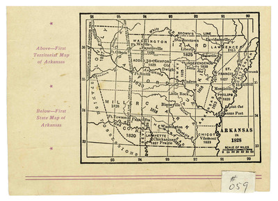
Black and white printed map of Arkansas Territory and its counties, circa 1828. This map is on a page that appears to have been taken from a book, and shows boundary lines for the territory and its counties, the years in which those boundaries were set, some towns, and larger rivers.
Biographical/Historical Note
Arkansas became a territory in 1819 and achieved statehood in 1836.
Physical Description
Map, 7.75" x 11.5"
Contributor
John H. Moore
Geographical Area
Arkansas
Language
English
Identifier
Map0059_1
Resource Type
Image
Collection
Map collection
Publisher
Arkansas State Archives
Contributing Entity
Arkansas State Archives
Recommended Citation
Arkansas in 1828, Map0059_1, Map collection, Arkansas State Archives, Little Rock, Arkansas.
Rights
Use and reproduction of images held by the Arkansas State Archives without prior written permission is prohibited. For information on reproducing images held by the Arkansas State Archives, please call 501-682-6901 or email at state.archives@arkansas.gov.
Disciplines
United States History


