
Preview
Date Original
1972
Description
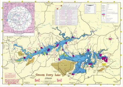
This 1972 brochure has a map of Greers Ferry Lake and its surroundings on one side, and has photographs of Greers Ferry Lake and its dam, descriptions of recreational opportunities, general information about the dam and reservoir project, and safety information on the other side.
Biographical/Historical Note
Construction began on Greers Ferry Dam in March 1959, and was finished in December of 1962. The dam's purpose was to control flooding along the Little Red River, and generate hydroelectric power for the area. The reservoir formed by the dam, Greers Ferry Lake, is also used for recreation. President John F. Kennedy dedicated the lake and dam on October 3rd, 1963, in his last major public appearance before the trip to Dallas where he was assassinated.
Physical Description
Brochure, 24" x 17"
Keywords
Waterways; Rivers; Hunting; Parks; Recreation; Facilities; Swimming; Fishing; Dams; Reservoirs; Safety; Water skiing; Parks
Geographical Area
Greers Ferry Lake; Little Red River; Cleburne County (Ark.); Van Buren County (Ark.); Stone County (Ark.)
Language
English
Identifier
Map0307_1
Resource Type
Image
Collection
Map collection
Publisher
Arkansas State Archives
Contributing Entity
Arkansas State Archives
Recommended Citation
Map of Greers Ferry Lake, Map0307, Map collection, Arkansas State Archives, Little Rock, Arkansas.
Rights
Use and reproduction of images held by the Arkansas State Archives without prior written permission is prohibited. For information on reproducing images held by the Arkansas State Archives, please call 501-682-6901 or email at state.archives@arkansas.gov.
Disciplines
United States History
Additional Content
Keywords
Waterways; Rivers; Hunting; Parks; Recreation; Facilities; Swimming; Fishing; Dams; Reservoirs; Safety; Water skiing; Parks


