
Preview
Date Original
1845-1860
Description
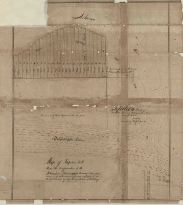
Hand drawn map of the town of Napoleon, Arkansas.
Biographical/Historical Note
The town of Napoleon was located at the confluence of the Arkansas River and Mississippi River. Napoleon no longer exists as it was destroyed by flooding in the 1870s.
Physical Description
Map, 21.5" x 24"
Geographical Area
Napoleon, Desha County, (Ark.)
Language
English
Identifier
Map0222
Resource Type
Image
Collection
Map collection
Publisher
Arkansas State Archives
Contributing Entity
Arkansas State Archives
Recommended Citation
Map of Napoleon, Arkansas, Map0222, Map collection, Arkansas State Archives, Little Rock, Arkansas
Rights
Use and reproduction of images held by the Arkansas State Archives without prior written permission is prohibited. For information on reproducing images held by the Arkansas State Archives, please call 501-682-6901 or email at state.archives@arkansas.gov.
Disciplines
United States History
Additional Content
COinS


