
Preview
Date Original
1826
Description
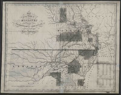
Black and white printed map of Missouri and the Arkansas Territory. The map shows state boundaries. The legend is in the bottom right corner and shows the population statistics of counties.
Biographical/Historical Note
Arkansas became a territory in 1819 and achieved statehood in 1836. D.H. Vance and J.H. Young were well-known map-makers who had a partnership with Finley Publishing. Eventually, Vance ended his association with Finley, but Young continued to make maps in association with Finley for several more decades.
Physical Description
Map, 22.5" x 17.75"
Contributor
A. Finley
Geographical Area
Arkansas; Missouri
Language
English
Identifier
Map0058
Resource Type
Image
Collection
Map collection
Publisher
Arkansas State Archives
Contributing Entity
Arkansas State Archives
Recommended Citation
Map of the State of Missouri and Territory of Arkansas, Map0058, Map collection, Arkansas State Archives, Little Rock, Arkansas.
Rights
Use and reproduction of images held by the Arkansas State Archives without prior written permission is prohibited. For information on reproducing images held by the Arkansas State Archives, please call 501-682-6901 or email at state.archives@arkansas.gov.
Disciplines
United States History


