Files
Download Full Text (807 KB)
Date Original
1957
Description
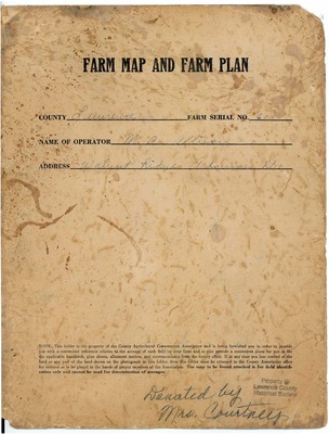
The Farm Map and Plan was part of the soil conservation efforts that were enacted after the Dust Bowl in the 1920s. In this plan, there is an aerial picture of the Allison farm from the Soil Conservation Service photogrammetry department as well as handwritten descriptions of the land.
Physical Description
Document, 9" x 11.75"
Subjects
Agriculture; Agricultural productivity; Farming; Farmers; Farm life; Farms; Croplands; Land use; Conservation of natural resources; Soil conservation
Contributor
M.A. Allison
Geographical Area
Walnut Ridge, Lawrence County (Ark.)
Language
English
Identifier
MSNE.0035, Box 1, Folder 43
Resource Type
Image
Collection
Powhatan Historic State Park collection, MSNE.00335
Publisher
Arkansas State Archives
Contributing Entity
Northeast Arkansas Regional Archives
Recommended Citation
Allison farm map and plan, Powhatan Historic State Park collection, Northeast Arkansas Regional Archives, Powhatan, Arkansas.
Rights
Use and reproduction of images held by the Arkansas State Archives without prior written permission is prohibited. For information on reproducing images held by the Arkansas State Archives, please call 501-682-6900 or email at state.archives@arkansas.gov.
Disciplines
Agriculture | United States History
Preview