
Preview
Date Original
1986
Description
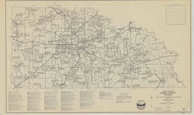
Printed sesquicentennial map of cemeteries and grave-sites in Union County, Arkansas. There is an alphabetical list of cemeteries and grave-sites with their coordinates at the bottom of the map.
Biographical/Historical Note
The Arkansas Sesquicentennial Celebration was in 1986, commemorating the 150th anniversary of Arkansas’s admission into the Union with a series of statewide and local events held to honor the anniversary. The celebration sparked a renewed interest in Arkansas and local history, as well as in genealogy across the state. County maps showing the locations of various cemeteries and grave-sites were created to help researchers in locating the resting places of their ancestors.
Physical Description
Map, 18" x 30"
Keywords
Cemeteries
Contributor
Arkansas State Highway and Transportation Department
Geographical Area
Union County, Arkansas
Language
English
Identifier
Map1810
Resource Type
Image
Collection
Map collection
Publisher
Arkansas State Archives
Contributing Entity
Arkansas State Archives
Recommended Citation
Arkansas Sesquicentennial Cemetery and Gravesite Map of Union County, Arkansas, Map1810, Map collection, Arkansas State Archives, Little Rock, Arkansas.
Rights
Use and reproduction of images held by the Arkansas State Archives without prior written permission is prohibited. For information on reproducing images held by the Arkansas State Archives, please call 501-682-6901 or email at state.archives@arkansas.gov.
Disciplines
United States History
Additional Content
Keywords
Cemeteries


