
Preview
Date Original
1852
Description
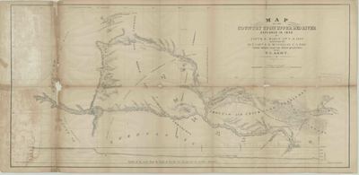
Printed map of the land above the Upper Red River as explored in 1852 by Capt. R.B. Marcy. The map shows territories inhabited by Kiowas, Choctaw, Chickasaw, and Middle and Southern Comanche.
Biographical/Historical Note
Randolph Barnes Marcy (April 9, 1812 – November 22, 1887) was a career officer in the United States Army, achieving the rank of Brigadier General before retiring in 1881.
In 1852, Capt. Marcy was in charge of the expedition that first reached the headwaters of both forks of the Red River, which official parties had tried to find since 1806. The Ke-che-ah-que-ho-no is the main branch of the Red River.
Physical Description
Map, 17" x 36"
Keywords
Rivers; Waterways
Contributor
Capt. R.B. Marcy, Capt. G.B. McClellan, U.S. Army
Geographical Area
Upper Red River
Language
English
Identifier
Map1638
Resource Type
Image
Collection
Map collection
Publisher
Arkansas State Archives
Contributing Entity
Arkansas State Archives
Recommended Citation
Map of the Country Upon Upper Red River, Map1638, Map collection, Arkansas State Archives, Little Rock, Arkansas.
Rights
Use and reproduction of images held by the Arkansas State Archives without prior written permission is prohibited. For information on reproducing images held by the Arkansas State Archives, please call 501-682-6901 or email at state.archives@arkansas.gov.
Disciplines
United States History
Additional Content
Keywords
Rivers; Waterways


